For newcomers

At the bottom of each post there is the word "comments". If you click on it you will see comments made by followers, and if you follow the instructions you may also comment and I always welcome that. I have found many people overlook this part of the blog which is often more interesting than the original post!

My blog nick-name is SIR HUGH. I'm not from the aristocracy - my middle name is Hugh which relates to the list of 282 hills in Scotland compiled by Sir Hugh Munro in 1891. I climbed my last one (Sgurr Mor) on 28th June 2009

****************************

Sunday 21 February 2010

61 - Competition puzzle resolved,Geocaching, and proper walking

I have now had a reply from the Ordnance Survey about the object attached to one of their trig points (see my posts 57 & 58).

Thank you for your email

I have had confirmation that this is an orienteering punch.
However this 'addition' is nothing to do with Ordnance Survey and it is
likely we would have to remove it should we (or any other surveyor) wish
to set equipment on the Trig Pillar.
Thank you for informing us however there is no further information we
can give.


Kind regards


Lesley Flood
Customer Service Adviser
Customer Service Centre, Ordnance Survey
Room C454, Romsey Road, SOUTHAMPTON, United Kingdom, SO16 4GU
Phone: +44 (0) 8456 05 05 05
Fax: +44 (0) 23 8079 2615
I wouldn't want to carry many of those things around in my rucksack if I was an orienteering marshall.
                                   *************************************
GEOCACHING
This  pursuit is becoming  addictive. You may notice the  logo on my blog which  automatically records the number of caches I have visited  after I have recorded them on the Geocache site. So far I have found sixteen, one of which required two visits due to my ignorance of the affairs of the band called Oasis and something to do with "Wunderwall", knowledge of which was required to interpret the clue about the location. The solution was gleaned from my daughter Jill who was appalled and amused at this gap in my education, and I was forced to listen to the song! Looking at profiles of other geocachers I see some who have found several thousand caches!

Here are some Geocache pics:
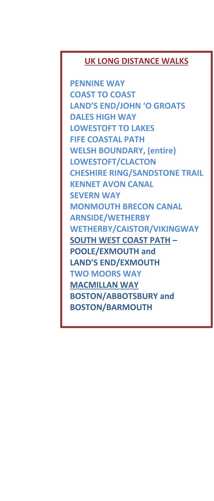


                                                 ***********************************
PROPER WALKING
In the last couple of days I  printed off sheets from Memory Map with the route marked  for my proposed walk from Lowestoft to St Bees Head which I intend to do after walking in France during May and June. The print off runs to fifty three pages of A4, and this gives some enlargement of the 1:50000 map. I will probably post half of these ahead to save weight, although they are not too heavy, and certainly much better than carrying all the maps.

Saturday 13 February 2010

60 - Horseplay

I went off Geocaching with my daughter this afternoon. I am sure everybody will be amused to follow our video on YouTube:  http://www.youtube.com/watch?v=BdhhGmDi7Ek

Friday 12 February 2010

59 - More trig points from OS Sheet 91 - Appleby-in-Westmorland

A very cold clear blue sky day. I was accompanied by Pete and Jake the dog.
1. Nettle Hill (Crosby Garrett Fell) 382m - NY 716 078
The ascent was from the road north of Newbiggin-on-Lune - NY 693 065. A very agreeable walk over cropped turf and approximately a six kilometer round trip. Great views of the northern Pennines with lots of snow on Cross Fell.


Above and below:  Nettle Hill  and distant Cross Fell with snow 


On the way down we broke some ice on a little pond so that Jake could have a drink


2. Struttforth Hill 184m - NY 742 124
On the way to this one we visited and found the Geocache - Musgrave Nano

This trig was off the public footpath which leads to Soulby and involved negotiating two barbed wire fences - all a bit naughty, but there was no nearby farm where we could have asked permission.


3. Heights 216m - NY 702 148 

Ascent was from Brow Foot up a track leading to a house. The map shows an interconnecting public footpath between this house and another to the south east, but a gate was barring the way and there was no indication of right of way. A man was working there on a felled tree and we spoke to him. At first he was very prickly, but after a certain amount of diplomacy, and no mention of our rights to the public footpath by us, he came round and then seemed to want to talk for the rest of the afternoon. He advised us to call at the adjacent house to ask for permission to go to the trig which we did.
On approaching the trig in the corner of a field we noticed that muck spreading activity had been carried out close to the trig, then we realised we could hear the tractor coming back with another full load. Pete urged me to hurry and get my photos before the tractor returned with the threat of us being covered with you know what.


Looking north to Dufton Fell

You can just see the tractor approaching down the side of the wall and a worried Pete hoping I am going to complete the mission in time.

Tuesday 9 February 2010

58 - Competition follow up

I emailed  British Orienteering about the trig point object - here is the reply:

Conrad

I have been in touch with the local orienteering club and regional development officer. Neither have any knowledge as to why an orienteering punch is attached to the trig point. One suggestion is that it may be linked to fell races (3 peaks?)or some LDWA challenge.
Regards

Celia Watkinson
Regional Development Officer
British Orienteering
Email: celia@britishorienteering.org.uk
Tel: 0117 9688627

I have now sent a query to Ordnance Survey. I will post the result as and when I receive a reply. The last time I tried to get some information from the OS I did not get a reply.

I've just got onto Geocaching, but more of that later.